All your saved places, turned into a city plan.

Drop the cafés, galleries, and neighborhoods you want to visit onto a calm map, organize them by day with real walking routes, and share the finished trip as a travel zine or framed print.

No account required to start. Saves locally in your browser or syncs across devices when you sign in.

Open the map and start pinning in seconds.

Zero paywalls, zero onboarding forms. Launch straight into your workspace or open a pre-pinned city to try it out.

Jump straight into a city: London Amsterdam Tokyo Corfu Copenhagen Marrakech
Scout → Walk → Keep

Calm by default. Deep when you want it.

Most trip planners bury you in tabs, ads, and spreadsheet rows. PlanCityTrips guides one calm loop—from scouting neighborhoods before you go, to walking the route together, to keeping a Zine or framed print when you're home.

01 · Scout

Before you fly

Import saved lists or ChatGPT picks, explore neighborhoods with zero ad clutter, and group spots by vibe.

02 · Walk

On the ground

Turn pins into walkable daily routes, hand off to live transit when needed, and co-edit with friends.

03 · Keep

After you're home

Match camera-roll photos privately on your device, share an editorial Zine, or print a 300 DPI map.

Scout · 01 / Calm workspace

Start with a clean map, layer on deeper tools as you go

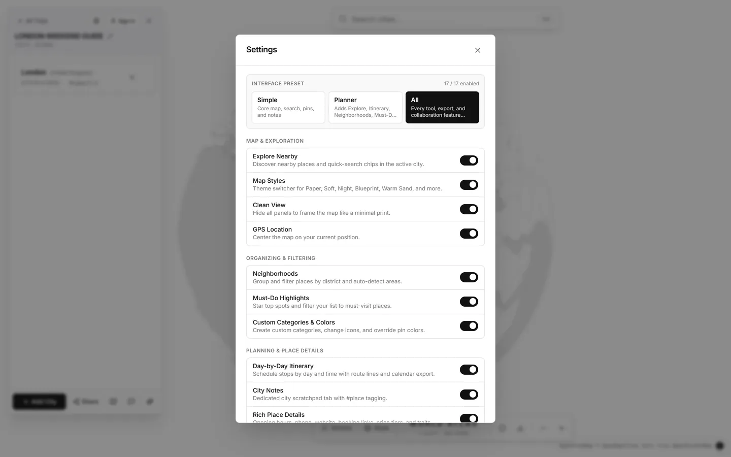
First launch opens in Simple mode: just the 3D globe, search, pins, and notes. Open Settings anytime to switch to Planner or All, or toggle itinerary, neighborhood, photo, and print tools individually without losing data.

  • Three workspace presets: Simple, Planner, and All
  • Organize Trips → Cities → Pins in one clean atlas
  • Works offline in Guest Mode; syncs across devices when you sign in
See Getting Started in Help
Settings dialog showing Simple, Planner, and All interface presets and grouped feature toggles
Scout · 02 / Neighborhood discovery

Scout districts without commercial map clutter

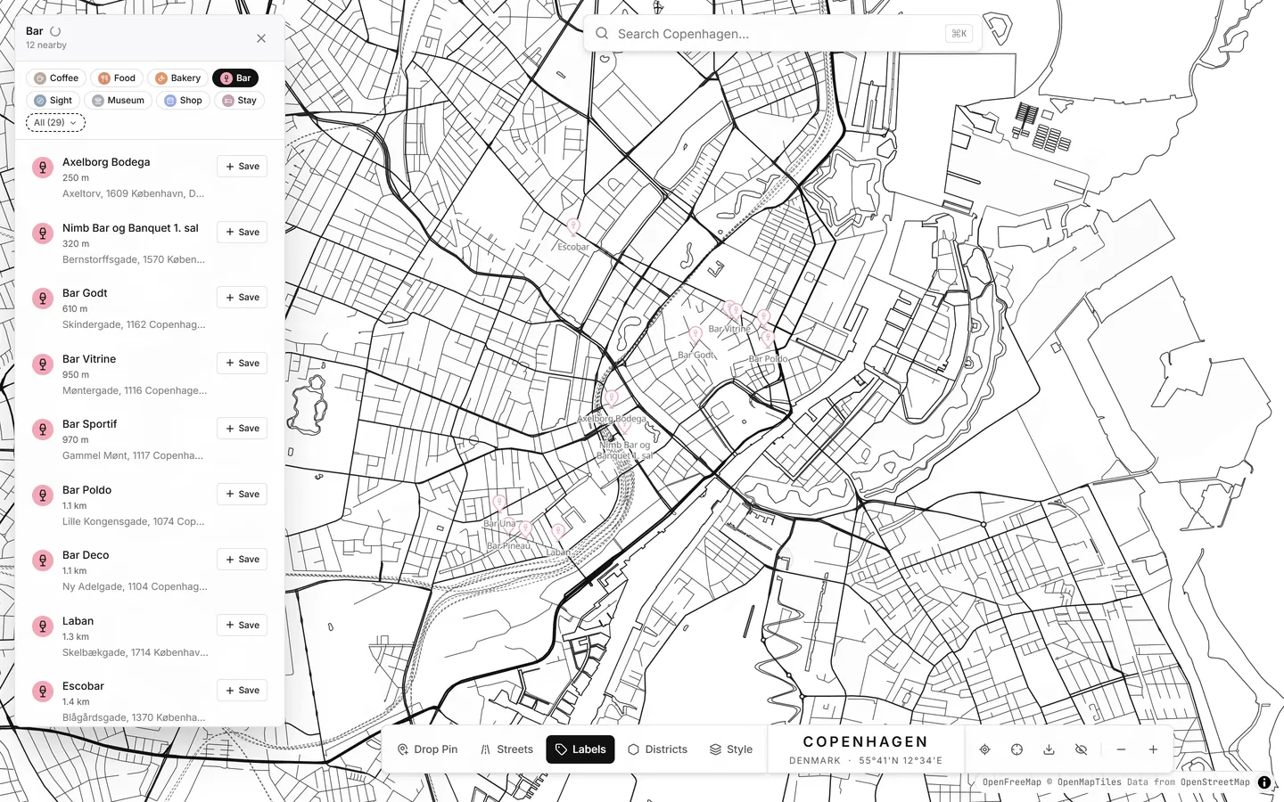
Tap Coffee, Bar, Food, Bakery, Museum, or Stay in any city to surface local spots in milliseconds—with zero ads or sponsored pins. Toggle neighborhood boundaries (D) to tag district vibes and switch between 7 curated map styles.

  • 7 map styles: Paper, Soft, High Contrast, Night, Warm Sand, Blueprint, Botanical
  • 52 custom map icons paired with 60 pastel & custom color swatches
  • Save opening hours, price tier, phone, social links, booking status, and traits
See Discovery & Places in Help
Copenhagen map showing instant bar discovery results and clean pins
Walk · 03 / Day-by-day itineraries

Turn pinned spots into walkable daily routes

Switch to the Itinerary tab inside any city to schedule stops by day and time. Use Auto-Plan to group nearby places into logical days, preview Walk, Bike, or Drive street lines on the map, or export straight to your calendar.

  • Real street routes with leg durations and one-tap route ordering
  • Direct Google Maps Transit handoff when you need live subway or bus times
  • Print-ready itinerary summary and Apple, Google & Outlook calendar export (.ics)
See Itineraries & Routes in Help
Keep · 04 / Notes, imports & photos

Bring lists from anywhere—and photos after the trip

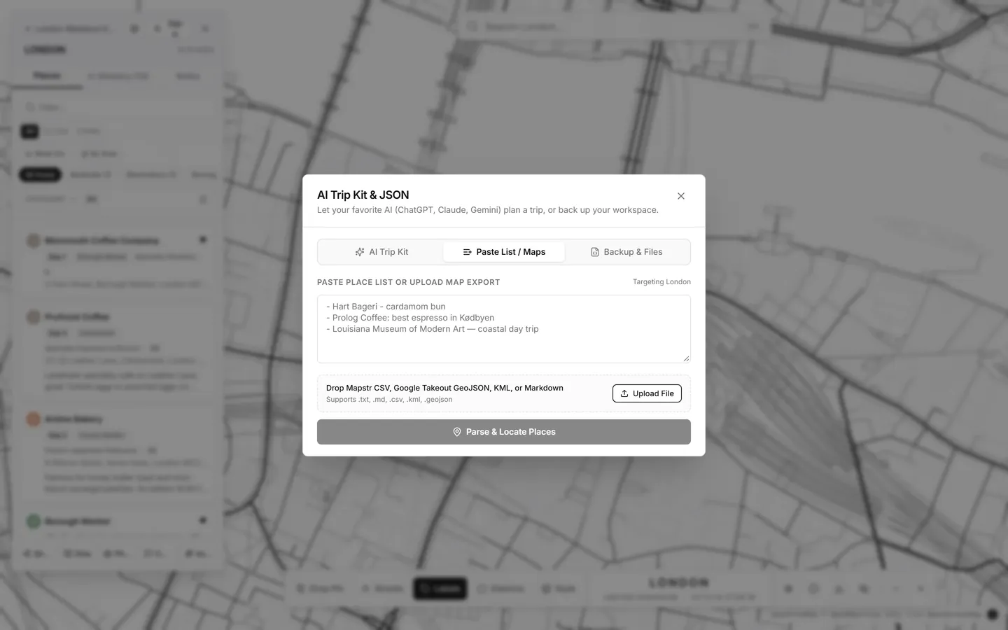
Paste a bulleted list from Notes or ChatGPT, import Mapstr or Google Maps Saved Places, and preview every pin first. Type #PlaceName in your notes to link straight to any pin, or drop your camera roll to match trip photos to nearby stops automatically.

  • Built-in AI Trip Prompt Kit to turn ChatGPT or Claude guides into mappable pins
  • Matches camera-roll photos by time and GPS—processed privately on your device
  • Portable backups you own (JSON & GeoJSON)—zero vendor lock-in
See Import, Notes & Photos in Help
Import and Backup dialog showing AI Trip Kit, Paste List / Maps, and Backup & Files tabs
Keep · 05 / Share, zine & print

Co-edit live, publish a zine, or frame a 300 DPI poster

Invite travel partners as Editors or Viewers with real-time sync and @Pin Trip Chat, switch any trip into a clean printable Zine View where friends can click Clone to My Trip, or open the Poster Designer to export crisp vector SVG and 300 DPI prints with bleed marks.

  • Public read-only Zine links work in any browser—no account needed
  • Multi-page printable Zine PDF layout with clickable place mentions
  • Poster Designer with 7 styles, 24 fonts, and framed or full-bleed print scales
See Sharing, Zine & Poster Export in Help
Pricing

Free for personal planning. Pay only for keepsakes or power trips.

Core city mapping, discovery, itineraries, and portable JSON/GeoJSON backups stay free. Unlock print-ready posters per trip with no subscription—or go Pro for unlimited trips and smart tools. All features are open at no cost during Early Access.

Free Forever

$0 no credit card required
  • ✓Up to 3 active Trips with unlimited Cities & Pins
  • ✓All 7 map styles, 52 icons & 60 color swatches
  • ✓Day-by-day itineraries, street routes & calendar export (.ics)
  • ✓Instant local venue discovery & Google Maps / list import
  • ✓Cloud sync (Google / Email) + up to 2 collaborators & 3 Zine links
  • ✓Web-res map exports & portable JSON / GeoJSON backup
Start Planning

Keepsake Print Pass Free in Early Access

$9 one-off per trip · no subscription
  • ✓300 DPI PNG & JPEG print-ready poster exports for that trip
  • ✓Hybrid-vector SVG export with optional 3 mm crop & bleed marks
  • ✓All 7 map styles, 24 curated fonts & custom poster captions
  • ✓Multi-page printable Zine PDF layout with clickable stops
  • ✓Re-export anytime as you tweak pins or typography
Try Poster Designer
FAQ

Common questions

Do I need an account to start planning?
No. Click Start Planning to open the map immediately in Guest Mode. Everything saves in your browser, and if you sign in later with Google or email, you can upload your local trips to the cloud in one click.
Why do I only see basic tools at first?
New workspaces start in the Simple preset so the screen stays calm. Open Settings (gear icon in the sidebar) anytime to switch to Planner or All, or turn on itinerary, neighborhood, photo, or print tools individually.
Can I import places from Google Maps, Mapstr, or an AI chat?
Yes. Open Import & Backup to paste any plain-text or Markdown list, copy our AI Deep-Research prompt, or upload Mapstr (.csv / .kml) and Google Maps Takeout (.geojson / .json) files.
Can I export my data or delete my account cleanly?
Yes. Export your entire workspace or any single city as JSON or GeoJSON anytime, and permanently delete your cloud account and all owned trips directly inside the Account dialog.
How do Free, the Keepsake Print Pass, and Pro compare?
Core mapping, unlimited pins, itineraries, and portable JSON/GeoJSON backups are Free Forever. When billing turns on after Early Access, you can unlock 300 DPI print-ready posters and Zine PDFs per trip with a $9 one-off Keepsake Print Pass, or subscribe to Pro ($4/month or $29/year) for unlimited trips, unlimited print exports, unlimited collaborators and Zine links, Auto-Plan route clustering, and private camera-roll photo matching.