Help Topics
Districts, Vibes & Map Styles
Read a city by neighborhood instead of flat pins, annotate districts with vibes and stay recommendations, and switch between 7 map themes.
1. Neighborhood Districts Overlay & Vibes
Press D or click the Toggle district boundaries icon in the map toolbar to load real OpenStreetMap district polygons over the city.
Click any district polygon on the map—or switch your Places list to By Neighborhood and click a district header—to open the District Inspector.
Toggle vibes like Stay Here, Foodie, Walkable, Nightlife, Design & Shops, Culture, Quiet / Local, or Skip, write a neighborhood summary, and pick a custom polygon tint color.
2. All 7 Map Styles & Clean View
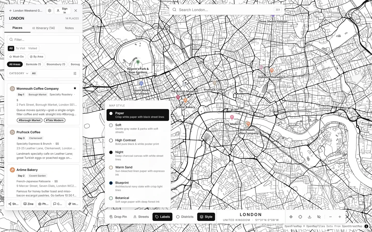
Click Style in the bottom-right map toolbar to switch between seven curated themes:
- Paper: Crisp white paper with black street lines.
- Soft: Gentle gray water & parks with soft streets.
- High Contrast: Bold pure black & white poster print.
- Night: Deep charcoal canvas with white street lines.
- Warm Sand: Sun-bleached linen paper with espresso ink.
- Blueprint: Architectural navy slate with crisp light lines.
- Botanical: Soft sage paper with deep forest ink.
You can also toggle street names (R), pin labels (L), center on your live GPS position (Locate me), or press Clean View to hide every panel for distraction-free browsing.